Search This Blog

Tuesday, October 25, 2011

Two Americas

"Growing old is mandatory, growing up is optional" — Roadside sign along the Lincoln Highway in Nebraska.

Yesterday President Obama spent time in Los Angeles raising money for his 2012 election campaign. He visited a Mexican restaurant to gain favor with Hispanic voters. After tasting some spicy chicken wings he was off to the home of Melanie Griffith to attend a fund raising dinner hosted by her and actor Antonio Banderas along with other Hollywood moguls.

In New York City the Occupying Wall Street gang continues to camp out on private property with the support of New York’s liberal mayor, Michael Bloomberg. The welfare lovers, Marxists academics, and college students have been camping out for almost a month demanding an end to capitalism, free college, forgiveness of student loans, and a grocery list of socialist programs.

In Madison Wisconsin we have seen teachers along with public sector union thugs and college students rioting against minor cuts in pension and health care contributions proposed and enacted by Governor Scott Walker and the state legislators. These protestors caused over one million dollars in damage to the state capitol building while demanding more benefits.

These are just three examples of what had been happening on the east and west coasts and major urban centers where union, academics, welfare recipients, teachers, and college students are demanding more and more from the American taxpayer. These are the protests and rallies that draw the attention of the media, celebrates and talking heads.

There is another America we do not hear much about unless there is a flood, tornado or other natural disaster. This is the America where people go to work every day to support their families, tend to their farms, and run their small business. It is the county of Wal-Mart, Target, and Home Depot. It is a part of the country we refer to as “Fly-over County.”

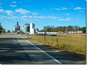
I have recently completed a road trip along the historic Lincoln Highway from Pennsylvania to California. My wife and I spent fourteen days driving through Pennsylvania, West Virginia, Ohio, Indiana, Illinois, Iowa, Nebraska, Wyoming, Utah, Nevada and California driving the Lincoln Highway andFXP_9092 exploring the small towns along the route. We ate at local cafes. We saw the vast farm lands of Ohio, Indiana, Illinois, Iowa, and Nebraska. We saw the cattle county of Wyoming and Utah. We passed through the fall foliage in the mountains of Pennsylvania and West Virginia. We saw the vast agriculture of California’s central valley where the environmentalist in San Francisco have cut off the water supply for the farms and almond orchards to protect a tiny fish they believe is being harmed in San Francisco Bay. We saw farm equipment and truck dealers that were much more prevalent than BMW, Mercedes, and Lexus showrooms. We saw acres and acres of corn and beans in Iowa and Nebraska where farmers work from dusk to dawn seven days a week tending their crops while being good custodians of the land they farm.
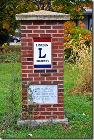
These are the people the elites call hayseeds and boobs. They grow our food, raise our meat, mine our minerals, and drill for our oil. They pay billions is taxes and obey the law. They are for the most part conservative and patriotic because they believe in the word “conserve.” They conserve the traditions, values and land of America. They fly American flags on their houses and buildings. They construct memorials to their ancestors, sons and daughters that have sacrificed their lives at Saratoga, Gettysburg, Belleau Wood, Iwo Jima, The Chosen Reservoir, Khe Sanh, Fallujah, and Kandahar. They invest in their farms and businesses. They spend a quarter of a million dollars for harvesting machines and tractors that rival a Mercedes in comfort and technology.

The people in this fly-over county drive pickup trucks and SUVs not Priuses and Chevy Volts. They invest in enormous grain storage silos, irrigation equipment, road maintenance, and their local schools. Their schools and public buildings fly the American Flag, not the Mexican Flag. They preserve their historic buildings, traditions, and culture.
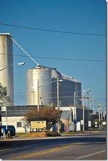
FXP_9358This is the America the media pays little attention. It’s the America many of us grew up in where political correctness was never heard off. It’s the America where owning a gun is considered a right not to be tampered with and Washington, D.C. is not high on their list of concerns, except when the EPA begins to pile on regulations that affect their ability to make a living.

If you remove the influence of the big urban centers like Philadelphia, Cleveland, Chicago, Des Moines, and Omaha these states would be listed as red states. Red states in the context of voting Republican and conservative, not in the context of Marxism or socialism.

It would be good to see those freaks and parasites demanding an end to capitalism and government handouts who our protesting in New York, Los Angeles and other big cities to pay a visit to this fly-over country and work a few weeks on a farm of in a small business so they could complete their expensive, elite education by getting their hands soiled producing something rather than rhetoric. Perhaps they would develop a love of country and the values that have endured in Middle America for these many years.
Wednesday, October 19, 2011

Day Nineteen of Our Lincoln Highway Road Trip

Today was our last day of our Lincoln Highway adventure. So far we have traveled 7,219 miles and with our trip home from Sacramento tomorrow we should end up with a total distance traveled of 7,700 miles in nineteen days.

This morning we were up at 6:00 am again and we decided not to partake in the lousy continental breakfast offered by the Days Inn we were staying at. Instead we loaded the car and went around the corner to Carrows for a real American breakfast of bacon, eggs, hash browns and toast. This was the first time we did not eat the breakfast offered by the hotel. The breakfast offered by the hotels we stayed at ranked with Comfort Inn as number 1, Super-8 at number 2, and Days Inn as last.

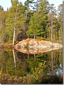
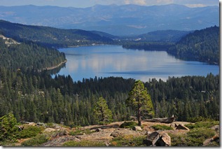
Our first stop was at Idlewild Park, in Reno, where there was supposed to be a monument to the Lincoln Highway and the transcontinental railroad. We did not find the monument, but the scenery in the park was great, especially the reflections of the trees in the calm water.

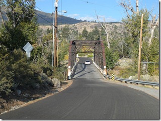
We then traveled west on I-80 to the little hamlet of Verdi to search for theDSCN3202 iron monument marking the boundary of California and Nevada. We had to do some exploring to locate the monument and we found it surrounded by a chain link fence to protect it from vandals and souvenir hunters. The drive up to the state line passed through some very scenic countryside and the old iron bridge over the Truckee River was a terrific photo spot.

After spending time at the Truckee River and state line we made our way to Truckee, California to look for some markers for the Lincoln Highway which now was designated as US 40 in California. The railroad station, where the marker was located, was having its parking area renovated and there was no evidence of any marker. We stopped in the California Information Center and asked the girl behind the counter where the marker was. She told us it was in storage until the construction was completed. There was, however, a restored Flying A service station.

Truckee is a quaint little town with boutique shops and cafes. As were not hungry we took our pictures and got back on Historic US 40 heading for Donner Summit.

As we drove west on US 40 (Donner Summit Road) we stopped at the site of the infamous Donner Party and the tragedy that befell them in 1846 as they traveled to California. Only 48 of the 87 member party survived the snow and cold where they became stranded in the Sierra Nevada Mountains on their way to Sacramento. There were numerous reports of cannibalisms among those who survived the ordeal.

Once again we encountered construction as the park’s entrance and parking area was being renovated. The museum was opened and the exhibits told the story of the Donner Party and other pioneers braving the hardships of the Emigrant Trail to California.

We hiked some of the trails around the museum and once again the scenery was great especially around the river.

Our final stop before we headed for Sacramento was at Donner SummitFXP_9841 where we stopped at the Rainbow Bridge and saw evidence of where the original Lincoln Highway passed over the summit and through the Sierra Nevada Mountains. It must have been some task for those cars in the 1920s and 30s to traverse this highway on their way to San Francisco. There was even the remnant of a wrecked car that could not negotiate the curves and tumbled down the mountain. The scenery on this portion of US 40 was magnificent.

After we climbed to the summit and began our downward passage we rejoined I-80 and headed for Sacramento. Our Lincoln Highway adventure had come to an end and we would be going home on Interstate 5.

You can see all of my pictures by clicking here. Don’t forget to click the “Slideshow” button at the upper right to view the largest image.

In the coming weeks watch for my newsletter articles about the Lincoln Highway. I will discuss its history and significance to the United States

Tuesday, October 18, 2011

Day Eighteen of Our Lincoln Highway Road Trip

Today marked the beginning of the home stretch for our 395, Trans-Canada, and Lincoln Highway road trip. So far we have travelled about 6,800 miles and coved a lot of road. We have seen prairies, mountains, fall foliage, and grain silos. We have had an accident with our 2001 Toyota Van and completed the trip with a new Ford Expedition from Enterprise Car Rental. To date I have posted 937 photos — about 40% of the total I have taken. For the most part the weather has been clear and mild.

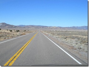
On this 18th day we travelled on US 50 from Wendover, Utah to Reno,DSCN3114 Nevada. US 50 follows the trace of the Lincoln Highway and is known as the loneliest highway in the United States, and believe me it is. It goes southwesterly from Wendover to Reno and crosses some of the most desolate lands in Nevada. The road is good and mostly straight. It goes through a few towns like Ely, Eureka and Austin before reaching Fallon, Nevada. We were lucky to find a café in Austin that offered good, inexpensive food.

Outside of these few towns and an old pony express station it was a very boring, uneventful drive. We arrived in Reno at 5:00 pm, checked into our hotel, and jelled out for the night.

Tomorrow we will climb the Sierras on I-80 to Sacramento and then on Thursday we will head for home on I-5. Kathy and I are now looking forward to getting home. We have a lot to do including swapping our rental car for a more economical vehicle and buying another van. We will have a busy weekend.

You can see all of my pictures by clicking here. Don’t forget to click the “Slideshow” button at the upper right to view the largest image.

Till Wednesday night.

Monday, October 17, 2011

Days Sixteen and Seventeen of Our Lincoln Highway Road Trip

Day sixteen took us through Nebraska and into Wyoming. It was a Sunday and the day dawned clear and cool. Traffic was light and we left Ogallala on Route 30 and headed west through the fields of corn and numerous grain silos. There was not too much in a historic nature to see except a renovated 1930’s service station on Ogallala and an old hotel in Big Springs.

As we were breezing along on this beautiful morning listening to our SiriusFXP_9422 satellite radio looking forward to listening to the NFL games including the Rams-Packers game we got a shock. The radio lost reception and a message flashed on the information panel that we needed to call Sirius. We pulled over in Chappell, NE and called the 800 number indicated. We were told that the free introductory period had run out and we would need to buy a subscription to continue to enjoy the radio programming.

The customer service representative was very helpful and after several minutes of negotiation we were able to purchase a one month subscription for $10.00. This we did and continued on our way along the Lincoln Highway with the NFL station booming away. Of course the Rams lost to the Packers but it was nice listening to the games while driving the interstate. It relieves the boredom.

The scenery did not change much as we entered Wyoming at Pine Bluffs but we began to lose some of the original Lincoln Highway and had to jump over to Interstate 80. There was not too much to see except trucks and there were plenty of them. We did pass the big Sinclair refinery at Sinclair, WY before joining Interstate 80.

We reached the Continental Divide around 3:30 and took some photos of the Henry Joy Plaques at the Divide. Henry Joy was the president of the Packard Motor Company and big advocate of the Lincoln Highway. From the Divide we battled the trucks to our motel in Green River. At green river we ate at an authentic 1950’s diner.

Today we were on the road by 7:30 am and heading for Utah on Interstate 80. Our first stop was for a good cup of coffee at Little America on I-80. This is a complex of a service station, trading post, truck stop and motel that was rebuilt after the original Little America, on the Lincoln Highway, burnt to the ground in 1970.

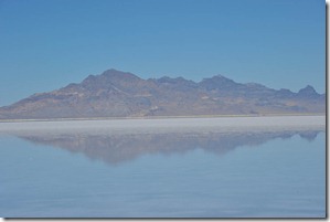
We breezed through the rest of Wyoming and crossed into Utah and I-80. FXP_9591One of the things I like with Utah is their rest stops. They are clean and always allow you a chance to walk about and enjoy Utah’s magnificent scenery. We bypassed Salt Lake City on I-80 and followed along the south shore of the Great Salt Lake passing the 1,125 foot high smoke stack of the Kennecott Copper Company’s copper smelting complex and the Bonneville Salt Flats on our way to Wendover, UT.

After we checked into our motel we made a visit to the U.S. Army Air Force Base at Wendover. It was at this base that thousands of young men were trained to fly and navigate B-17, B-24, and B-29 bombers during World War II. It was also the base where Coronel Paul Tibbits trained his crew to drop the atomic bombs on Japan.

The base is no longer operational and there is a small museum where youFXP_9623 can see some of the memorabilia and models of the base, the Enola Gay B-29 and the bomb that was dropped on Hiroshima. As I had relatives and friends who were trained at his base it was quite an experience to see where they learned to fly those flying fortresses.

After touring the base we ventured over the state line to West Wendover and the Montego Bay Hotel and Casino where we enjoyed a great buffet dinner and Kathy did some gambling while I watched the Jets-Dolphins game in the sports bar.

Tomorrow we will head south to Reno, Nevada and then on to Sacramento.

You can see all of my pictures by clicking here. Don’t forget to click the “Slideshow” button at the upper right to view the largest image.

Till Tuesday night.

Saturday, October 15, 2011

Day Fourteen and Fifteen of Our Lincoln Highway Road Trip

After a good night’s sleep at the Comfort Inn in Dixon, Illinois we were on the road by 7:00 am and heading for Iowa. The two things I had to do today were to forget about the accident with our van and get used to driving the behemoth Ford Expedition. The toughest thing to get used to was getting in and out. You need a step ladder to climb into the driver’s seat. Once on the road it is not too bad to drive, especially on the Interstates. You also have to get used to parking it. Another annoying thins is pulling up to the gas pumps. The vehicle is longer than you think and I have to pull past the pump farther than I am used to get the hose into the filler spout, which does not have a cap. It is designed for the new nozzles and you just insert the gas nozzle into the filler spout.

Iowa is flat and devoid of many trees. There is, however, a lot of corn. As we drove along the Lincoln Highway, Route 30, we saw fields and fields of corn. Some fields were being harvested while others were still waiting for the harvesting machines.

We only had a few miles left in Illinois until we reached the Mississippi River and crossed over into Iowa. But before we crossed we stopped at the Dutch windmill on the banks of the river. This windmill is there because a Dutch fellow with a love of windmills built it. It is a working windmill and one of the workers opened it up and gave us a tour of the interior of the mill. We saw the workings and how it ground the grain into flour. Due to the mills height above the river I was able to get some good shots of the river.

The Iowa DOT does a good job of marking the Lincoln Highway. It was veryDSCN2921 easy to follow the route with the numerous signs along the road. There was nothing really spectacular in Iowa except the section of the original brick paving on the Lincoln Highway and the numerous grain silos.

We reached Carter Lake, Iowa and ended our day of travel across Iowa at the Nebraska border at Omaha and the Missouri River. Much to our chagrin our motel was by the airport and there was a marked lack of restaurants so we went to the local Subway for dinner.

Today we were up early and ready to meet Nebraska. The Lincoln Highway in Nebraska pretty much follows Route 30. The day was clear and warm with a high of 85 degrees. Nebraska has more corn fields than you can imagine. All along the route there are fields of corn, farms and grain silos. It is amazing how much corn is grown here. We were also following the route of the Union Pacific Railroad and we saw at least twenty trains of 80 cars or more containing tank cars loaded with ethanol, corn and coal. Where the coal was coming from I don’t know, but there was plenty of it.

Along the way I stopped by a dealer selling farm machinery and talked with a young man who was fixing a harvesting machine. Los Angeles has their BMW and Mercedes dealers. Nebraska has their John Deere, Case, Massey Ferguson, GMC, and Ford dealers. Almost everyone drives a big pickup truck and I found out that most of the farmers own their farm machinery.

These harvesting machines are like luxury cars. The cabs are air conditionedFXP_9356 and equipped with radios, GPS and other comfort items. A Gleaner harvesting machine runs about $250,000. This is quite a pop for a corn farmer as he also has a $100,000 tractor and several other expensive pieces of equipment. The farms also have a complex of silos to store the grain.

People, especially the elite, laugh at these farmers. Because they do not have a degree from Princeton, Harvard, Yale, or Columbia those who do look down their noses at the people who feed us. These farmers work dawn to dusk seven days a week to plant, fertilize, care for and harvest the grains and beans we buy at the supermarket at the lowest prices in the world. They fight the government, taxes and the weather to give us our daily bread. They are generally conservative, patriotic and good care takers of the land God gave them.

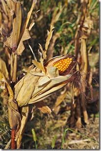
The corn we saw looked like it was dead, but upon closer inspection it wasFXP_9364 not. Most of the corn we saw is used either for cattle feed, corn syrup or ethanol. Corn leads all other crops in value and volume of production. Here are some more interesting facts about corn:

  • Iowa, Illinois, Nebraska and Minnesota account for over 50 percent of the corn grown in the U.S.
  • Corn is a major component in many food items like cereals, peanut butter, snack foods and soft drinks.
  • Each year, a single U.S. farmer provides food and fiber for 129 people - 97 in the U.S. and 32 overseas.
  • In the U.S., corn production measures more than 2 times that of any other crop.
  • Over 55% of Iowa's corn goes to foreign markets. The rest is used in other parts of the United States
  • The United States produces 333 million tons of corn each year and the closest competitor is China at 163 million.

As you can see corn is a very important crop in the United States and the farmers of Iowa and Nebraska make a major contribution

Our last stop on the Lincoln Highway was Buffalo Bill’s house in North Platte, NE. Unfortunately the house was closed and we did not get to go inside. The house was built in 1886 and is quite ornate and picturesque.

Our stop for the night was at the Super-8 motel in Ogallala, Nebraska. Tomorrow we will head west through Nebraska and enter into Wyoming.

You can see all of my pictures by clicking here. Don’t forget to click the “Slideshow” button at the upper right to view the largest image.

Till Saturday night.

Thursday, October 13, 2011

Day Thirteen of Our Lincoln Highway Road Trip

Up at 6:00 am and greeted by another day of rain, Ugh! Nothing we can do about the rain so we just have to do the best we can and take photos when we can.

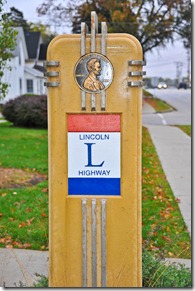
We were off on the Lincoln Highway heading west through Illinois. The Illinois DOT has done a great job of marking the Lincoln Highway. They have the little red, white and blue signs marking every turn in the road. Sometimes we wondered where the road was taking us as we wound through little towns and roads that were barely paved.

We found most of the landmarks we were looking for and some murals andFXP_9160 plaques describing the history of the road. These signs were contained in little gazebos along the road. This was good as we were able to avoid the rain when taking the photos.

In a little town called Franklin Grove we found the headquarters for the Lincoln Highway Association. We spent about an hour there talking with the woman, Lynn Asp, in charge of things. Lynn could not stop talking and related the entire history of the town and the highway in Illinois. Of course we bought some Lincoln Highway souvenirs and a few books.

After our time in the store we walked across the street to the little café for lunch. The café is a family run affair and the food was good and very inexpensive. Most of the locals were there eating lunch. We had a good lunch and were back on the road again. Things were going great. And then disaster struck.

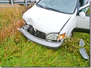
We were driving west on Gap Road, the Lincoln Highway, when we approached a badly marked ninety degree turn to the right. I did not navigate the turn well and went into a skid, smashed through the guard rail and went down the embankment. We were not hurt and the air bags did not deploy but the van was in bad shape.

Fortunately a local volunteer fireman was passing by and used his phone to contact the police and a tow truck. About five minutes later another couple stopped to see if they could help. They were all extremely nice and helpful.

It took about twenty minutes for the tow truck to arrive from the city ofDSCN2815 Dixon and another ten for the Lee County deputy sheriff to arrive. Once the deputy arrived and got all of our information the tow truck operator pulled the van onto the flat bed tow truck and we sat with the deputy and gave him all of the information. The guard rail was badly damaged and so was the van. The deputy did not cite us, which was good.

After finishing with the deputy Kathy and climbed into to tow truck and we were off to Dixon Auto Body Clinic. I now had to contact Encompass Insurance to file a claim. This took about a half hour on the phone answering a million questions. I finally got a claim number, but I had a problem arranging for a rental car. The claims agent wanted me to contact Enterprise in Sterling, but they were out of business. He did not have the Enterprise rental agency in Dixon on his list and told me to rent the car and save the receipts for reimbursement latter. I did not like this so I contacted my Encompass agent in Irvine, CA and had her call the claims people.

Lowell Ward at Dixon Auto Body looked at the car and ran a rough estimate. They would have to replace the right front fender panel, hood, lights, radiator, and bumper. Also the right from tie rod was damaged so it would have to be replaced. He came up with a preliminary estimate of $5,700. The van’s Blue Book value with its mileage is about $7,200. Lowell thought that the insurance company would only go for about 80% of the value which meant $5,700. It would be close and I think the insurance company will total the van.

I will not know until the adjuster looks at the van and files his report, which probably won’t happen until Monday. In any case even if they fix the van it will take three weeks. This means we will have to come back to Dixon and get the van and drive it home. This is not a very attractive situation.

I was finally contacted by the Encompass claims supervisor who told me to use the local Enterprise rental agency, which we had already made arrangement to do. The Enterprise agent arrived at the body shop about an hour after we contacted the agency and brought us a vehicle. The vehicle is a Ford Excursion, one big SUV. The cost for this vehicle is $54 per day and they are not charging us a drop charge. Encompass will cover $40 per day so it will only cost us $140.00 to drive this monster home. Yes, we decided to continue the Lincoln Highway adventure and return home on October 22nd.

Kathy and I decided there was nothing we could do here so we got a motel for the night and will continue our road trip in the morning. The Ford SUV is big, but does not have the space the van has. We had to take all of luggage and stuff out of the van and transfer it to the Ford. This was not an easy task. The Ford has all of the amenities including Sirius satellite radio which means we can listen to our favorite stations including the NFL games on Sunday.

The folks at Dixon auto Body were really very helpful to us and made us feel much better. Of course I am a physiological mess as I had to leave our beloved van in Illinois and will probably never see it again. I expect the insurance company to total the van and give us a check for its value. We will then have to but another van, probably a good used Toyota Sienna van – I hope. This is the last thing I wanted to do this year.

After a good night’s rest we will be back on the road again and things will look much better in the morning. I will have a new SUV with satellite radio and GPS to continue our road trip. The weather report looks good for the next few days so hopefully my next report will be more positive.

You can see all of my pictures by clicking here. Don’t forget to click the “Slideshow” button at the upper right to view the largest image.

Till Friday night, I hope.

Wednesday, October 12, 2011

Day Twelve of Our Lincoln Highway Road Trip

Today up at 06:00 at our hotel in Mansfield, Ohio and we were greeted by rain. It began raining during the night and by the time we finished breakfast, checked our maps and loaded the car it was still raining. Ugh! I think we are in for some rain the next few days. Oh, well we will just have tough it.

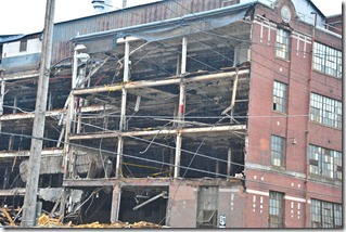
As we drove through Mansfield, not a pretty town, we passed the abandonedFXP_9080 Westinghouse appliance factory, a plant that once employed 7,000 people. Now the plant is being torn down and all of the jobs are gone, probably to China or Korea. So much for all of those union jobs.

After we got out of Mansfield we picked up the Lincoln Highway and began rolling though Ohio farm country. The Ohio DOT has done a good job of marking the highway. Around 10:00 am the rain quit and it began to clear. This was good.

I forgot how pretty the central and western Ohio farm country is. The farms are neat and the fields are well manicured. The smell of freshly cut hay and grass was terrific. These farmers are prosperous and conservative. I can remember hearing about the reactionary, conservative farmers in southern Ohio when I lived in Cleveland. I did not realize then how correct these farmers and citizens of the small towns are. They are patriotic as demonstrated by the American flags on their houses and the monuments in the town squares. The town of Delphos on the old Lincoln Highway had an impressive memorial to the fallen heroes of the town dating to the Civil War. There was also a terrific mural painted on the wall of a Firestone garage depicting the Lincoln Highway of bygone days.

We had to make a quick stop at a Rite Aid in Ontario, Ohio pick up some supplies for the trip. We needed ice, paper towel, crackers and a few other items. The store was neat and clean and the checkout clerk was friendly and helpful. Of course Kathy had to tell her all the details of the trip as she does everyone she meets.

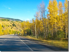
We found several of the historic markers for the highway along with someFXP_9092 great fall colors along the way. It almost makes me want to move back to Ohio where there are sensible people who believe in America. You just have to stay away from Cleveland and Toledo.

Around lunch time we crossed into Indiana where the Lincoln Highway is not marked as well as Ohio. We had lunch at a truck stop at the junction of Route 30 and I-69 on the outskirts of Fort Wayne, Indiana. We bypassed Fort Wayne as here was not much of the historical Lincoln Highway to see there and we wanted to make some time to get to our send destination of Joliet, Illinois and the Texas Road House for a great steak dinner.

We discovered the cheapest gas prices in Ohio at $3.19 per gallon. I don’t know why gas is so cheap. Another thing we like to do is stop at a McDonalds for a coffee and a pit stop.

When I went to use the restroom at the restaurant there was a black guy hanging about and he asked me for some money to buy a sandwich as his “comp” check had not come in. I ignored him and walked out. It’s a good thing he did not have a knife or some other weapon.

We had a good lunch and then were back on the road again. Now the sun was out and the farm lands of Indiana were as nice as those of Ohio. There were not many points of interest related to the Lincoln Highway in this part of Indiana so we jumped on the expressway and Interstate 94 for Chicago and Joliet.

We arrived at our Super-8 motel in Joliet very near the Hampton Inn where we stayed the first night of our Route 66 road trip. This is the location where the Lincoln Highway crosses historic Route 66. The Texas Road House where we had a great steak is the same restaurant we ate at the first night of our Route 66 trip.

Tomorrow is supposed to be partly sunny with a chance of showers as we make our way across Illinois and on to Cedar Rapids, Iowa. I hope the showers hold and the sun is predominant. I think we will see many historic points and some more lush farm lands.

You can see all of my pictures by clicking here. Don’t forget to click the “Slideshow” button at the upper right to view the largest image.

Till Thursday night.

Tuesday, October 11, 2011

Day Ten of Our Lincoln Highway Road Trip

Today we were on the road by 07:00 to explore the historic Lincoln Highway through Pennsylvania. We had our map books organized and the main points of interest identified. It was fairly easy to follow the track of the Lincoln Highway as it mainly followed US 30 with exceptions where US 30 was realigned. The Pennsylvanian Department of Transpiration (PennDOT) has done a great job of marking the Lincoln Highway with highway shields.

The weather was not as great as it had been for the past nine days. The skies were overcast but bright. No blue skies until midafternoon. Traffic was heavy because it was a holiday today (Columbus Day)

Interruption! I had to quit as I lost the Internet connection and could not upload any photos.

I am resuming on Day Eleven so I will combine the two day.

Day Ten Resumed.

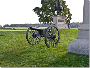
Our journey along the historic Lincoln Highway took us along US 30 through New Oxford and Gettysburg where we got some great photos. We had no problems following the route as it was marked well by PennDOT.

The day was one of those partially sunny days with a hazy sun andDSCN2502 sometimes breaks of blue. There were several murals painted on buildings and barns along the way and the autumn colors varied from town to town. There were some really neat colored trees along the country roads.

We stopped at a roadside fruit stand in St. Thomas, PA. They had some great farm grown tomatoes so I bought one and ate it on the spot. It was the best tomato I have had for years, ripened on the vine and fresh from the farm. Kathy bought some apples and gourds to take home to Gwen for decorating the house for Halloween and Thanksgiving.

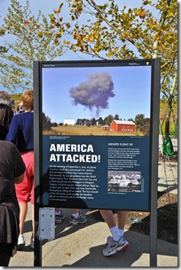
About 2:00 pm we arrived at the memorial for United Flight 93. This is the new memorial that is still under construction and I did not care for it. First you have to take a bus to the actual memorial and then hike about a half a mile to the wall with the names of the victims. I felt this new memorial was too cold. The old memorial was constructed by people and had more passion and warmth connected to it. This memorial was designed and built by engineers and architects and it looked like they were more concerned with their achievements than the victims of the terrorists. Also there were not enough restrooms.

We spent about two hours at the memorial; most of the time spent hikingFXP_8912 back to the wall of names and then back to the bus stop. It was good exercise. Also, unless you are a family member you cannot walk out to the large rock that serves of a headstone for the mass grave of the victims. Perhaps in a few years when the National Park Service gets some more money it will be a better memorial — I hope so.

Day Eleven: Greensburg, PA to Mansfield, Ohio.

We started out again at 07:30 am along US 30 towards Pittsburg and the Ohio River. I decided to take the Interstate in order to avoid going through Pittsburg during the morning rush hour. Even using the Interstate the traffic was heavy and there were the usual orange barrels blocking lanes for construction. I don’t think they ever stop fixing the roads in Pennsylvania.

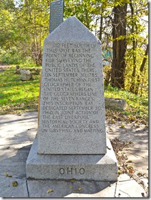
We crossed into a small portion of West Virginia where we got fuel and the visited the world’s largest tea pot at Chester, West Virginia. We then crossed of the Ohio River into the buckeye state and then made our way east along the river to the survey marker marking the boundary of Ohio and Pennsylvania and the beginning of Jefferson rectangular land scheme for the United States.

Once the Land Ordinance of 1785 was passed by Congress surveyors needed DSCN2661to establish the boundary of Pennsylvania and Ohio to implement the first seven ranges of the rectangular land scheme of townships and sections. This sectionalized land scheme, after being refined, became the basis of land in the United States, with the exception of the Mexican ranchos, west of this boundary marker. It was the basis for transferring land to soldiers in payment for their service in the revolutionary war, the homesteads of the mid-west, and building of the transcontinental railroad. It is also why the United States is the wealthiest land in the world. (See my article on “What Separates the Rich From the Poor.”) After practicing land surveying for 55 years I was quite excited to see the monument where the sectionalized land system began.

After leaving the boundary between Ohio and Pennsylvania we made our way west along US 30 and the Lincoln Highway. The Ohio Department of Transportation, like PennDOT, has done a great job of marking the historic Lincoln Highway. We meandered on and off US 30 to the old alignment of the Lincoln Highway and were able to locate one of the first test sections of the roadway. The test section was a one mile section of roadway where they engineers developed a standardized lane width and cross fall. This test section would be used as a standard for all subsequent constructions.

Abound noon we made it to Canton, Ohio and The Professional Football Hall of Fame. If you are a pro football fan this is a “must” visit. There are 267 busts of the hall of famers enshrined to this date. The exhibits are great and they tell the history of pro football from its founding days to the present. There are video displays, movies and of course a gift shop. The gift shop is great as you can buy everything from mouse pads and cups to jerseys of your favorite team.

We spent about two hours at the hall of fame and then got some lunch and visited the McKinley Memorial in Canton. Then it was time to head for Mansfield and our hotel. It was a great day with lots of fall colors and good Ohio scenery. Tomorrow we will travel through the remainder of Ohio and Indiana to Joliet, Illinois.

You can see all of my pictures by clicking here. Don’t forget to click the “Slideshow” button at the upper right to view the largest image.

Till Wednesday night.

Sunday, October 9, 2011

Day Eight and Nine of Our Lincoln Highway Road Trip

These would be two days of visiting my niece Cindy and her husband Vic and son Paul at their home in Cicero, New York. We had been looking forward to this visit for the last five days and were anxious to spend time with them and catch up on family issues.

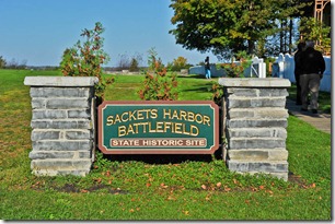
Before we arrived at their home we made two stops. The first was to visit the 1812 battlefield of Sackets Harbor just east of Watertown and the second stop was at an urgent care center. I’ll begin with the visit to Sackets Harbor.

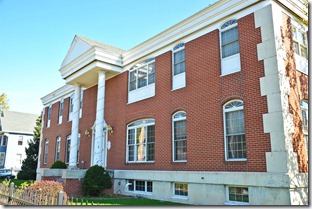
This day was day was another gorgeous day with clear blue skies and mildFXP_8736 temperatures. Sackets Harbor sits on the southern shore of Lake Ontario and was the site of a land and naval battle between the U.S, Navy and the British and Canadian forces in the war of 1812. Sackets Harbor is also the site of some beautiful homes, pleasant streets and a marina.

Kathy and I spent about an hour walking the entire state park and taking photos of the historic homes, monuments, informational plaques, and the burgeoning fall colors. The red barn set against the blue sky and lush green grass was especially impressive.

After leaving Sackets Harbor we wandered the back roads of Jefferson County past the farms and neat homes along the country roads. The fresh air and smells of freshly cut grass brought back memories of living in the outskirts of Cleveland and wandering the roads of Cuyahoga County in the autumn. It was a great experience.

Returning to Watertown we stopped at a Target store to see if the pharmacist could give Kathy something for her eye that was irritated and red. The Pharmacist told her eye was infected and she needed to see a physician. But, before leaving the store I picked up a calculator so Kathy did not have to long hand division to calculate our gas mileage and one of those magic window cleaners to keep our windshield sparkling.

Thanks to the GPS we located an urgent care facility in Watertown and after navigating the meandering city streets we found the urgent care facility. WeFXP_8750 walked in and were greeted by a helpful receptionist who took down all of Kathy’s information and medical insurance information. We had no problems with the medical insurance and after about a 20 minute wait we saw a physician’s assistant named Kerri who immediately diagnosed the problem as an eye infection (red eye) and prescribed some antibiotic eye drops which we purchased at the local Walgreens pharmacy for $40.00. Kathy has to use one drop in each eye three times each day for eight days and make sure she keeps her hands clean with antiseptic hand cleaner. After one day I can already see an improvement in her eye.

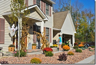
We left Watertown and drove for just over an hour to Vic and Cindy’s home in Cicero, NY. They have a great home on 12 acres right off State Route 31. The home is set back about 100 yards off the road and is surrounded by big trees.

Vic, Cindy and Paul greeted us with enthusiasm and made us feel right at home. When we arrived Vic and Paul were building their hot tub enclosure at the rear of the house. Vis is a military engineer who works on defense projects for Navy, but he finds time to serve as a Boy Scout Leader, volunteer fireman, carpenter, brick mason, tile layer, and general all around handyman. He has boundless energy and, along with Cindy and Paul, he has built most of his house. I envy him his talent and energy.

Vic is not only a great builder he also does a lot of the cooking and baking.FXP_8768 He made us delicious lasagna on Saturday night along with an apple pie from scratch. This morning he got up early and whipped up some omelets for us. I always knew Cindy married well.

Paul is an Eagle Scout and a senior in high school. He hopes to get into Ohio State to study aerospace engineering. I am sure he will do well in whatever he does. He is a great young man who is well grounded thanks to the great parenting of Vic and Cindy. I wanted to mention he should look into civil engineering due to his love of building stuff and Ohio State has a good CE program. That will be up to Paul to figure out and I am sure he will choose his passion.

After a very hospitable stay with Vic, Cindy and Paul (oh I almost forgot Midnight, their black Lab) we departed for York, Pennsylvania at 10:00 am. Our first stop was a car wash to get all of those Canadian bugs off of the car. Then Dunkin Donuts for a coffee for the road. We took I-81 south and headed for York, PA. The drive was easy, but the traffic was heavy, it looked as though everyone was on the road this Sunday, Perhaps it was the weather and the thought that this might be the last good weekend of the year. On our drive south on I-81 we passed two Tim Hortons in New York, I thought we saw the last of them in Canada, but obviously the Canadians have invaded New York once again. No, we did not stop at Tim Hortons, we had enough of them. Instead we stopped at a Subway for a meatball sandwich for lunch. Fortunately I had loaded up with antacids for the trip. The sandwich was good, but it lasted for a long time.

The fall colors are just now coming into full bloom and we are finally seeing the reds of the oaks. When we crossed in Pennsylvania we began to encounter the usual construction zones with their forest of orange barrels. If you want to make some good investments look for companies that make those barrels. You will not go wrong. When we got around Harrisburg it got squirrely with the construction, detours and constant turnoffs. Vic warned me that road work in Pennsylvania was never done and he was right on.

We arrived at our Super-8 in York PA at 16:30 and got settled in before looking for a dinner spot. The Indian desk clerk recommended the Round the Clock Diner just up the road from the hotel. The food was good and the prices very reasonable. After returning to the hotel we watched the Cardinals and Jets lose and now I am watching the Packers and Falcons. I think the Falcons will win, but you will know if I was correct when you read this blog. Since this was a bye week for the Rams I did not have to get frustrated today.

Tomorrow (Monday) we will begin our trek along the Historic Lincoln Highway. I hope we have the same weather we have had so far and I have good luck finding the historic places I have marked on my maps.

You can see all of my pictures by clicking here. Don’t forget to click the “Slideshow” button at the upper right to view the largest image.

Till Monday night.

Friday, October 7, 2011

Day Six and Seven of Our Lincoln Highway Road Trip

I did not post a blog yesterday as we got in to our hotel at Lake Kirkland late. We left Thunder Bay at 7:30 am and after a few stops for sightseeing and a picnic lurch we did not arrive at Lake Kirkland until 8:30 pm. It was a long drive but the weather was fantastic and scenery in northern Ontario was great.

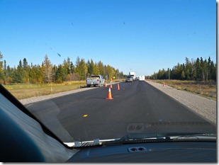
It was an uneventful day. No car problems, just numerous road closuresDSCN2372 where we were diverted to those one-lane deals due to road construction. It seems that the Canadians are working feverishly to complete all of their road repairs before the first snow fall. Believe me, many of their roads need these repairs. The heavy truck traffic is had on these two lane roads.

Canadians are lousy drivers. they either drive too fast or too slow and the trucks are always driving over the limit. I had a conversation with a fellow this morning in the breakfast room of the Comfort Inn and he told me that the Ontario Provincial Police (OPP) will normalcy ignore 10 to 15 kilometers per hour over the 90 k/per hour limit on the open roads. So I drove 10-15 kph over the limit. I did not see one OPP car until I reached Ottawa and it was going in the opposite direction.

The two-lane roads have 1 or 2 kilometer passing lanes about every 20 kilometers or so and this is where you get around the trucks and slow pokes. Believe me, they are welcome sights.

Just outside of Thunder Bay is the memorial to Terry Fox, the fellow with one leg who ran across Canada to raise money for the fight against cancer. It was quite impressive. Terry lost his right leg to cancer with an above the knee amputation and decided to run across Canada to raise money. He only got half way before the cancer returned and he was not able to make it all of the way. He was awarded many international honors for his brave endeavor.

We stopped for our picnic lunch at a very scenic spot at Longlac in the community of Greenstone. These picnic lunch stops not only save us money but more importantly they allow us time to walk about and take photos after sitting in the car for several hours. As long as the weather stays like it has been we will most defiantly continue with these picnic lunch stops.

Two things Canadians say a lot are “hey” and “for sure.” If you ask a Canadian a question like how far is the next gas station they will answer “ about a kilometer up the road hey for sure.”

When we checked into our hotel last night the desk clerk used about 25 “heys” and numerous “for sures.” It was driving me crazy.

Along the road to the border we passed Smooth Water Lake where the waterSmoothwater Lake was like a giant mirror with absolutely no ripples at all. I had to stop to take a few photos of this extremely picturesque spot. The reflections in the water were fantastic.

Today, according to the GPS we were scheduled to arrive at our hotel in Watertown, New York about 3:30 pm. We did not arrive until 6:30 due to two things. One was the numerous construction sites and the other was the border crossing at Ogdenburg and the Prescott Bridge. Things were going good until we arrived at the ICE check point and the customs officer told us we had been selected by the computer for a car check and told us to pull out of line and park in a designated area. We then had to go inside the building and answer a bunch of questions while the ICE officer went out and cheeked the vehicle. Obviously they did not find anything, but the entire procedure took about 30 minutes. I think I garnered his sympathies when I told him about the problem with the spare tire and fuel tank shield. He told us he had the same problem while on vacation in North Carolina last year, except he hit a 2x4 in the highway.

In our five days of driving across Canada we covered 2,637 miles and went through the provinces of British Columbia (partial) Alberta, Saskatchewan, Manitoba and most of Ontario. We stopped at Tim Hortons for lunch or breakfast five times and had two picnic lunches along the way. We saw a million birch trees in full fall color and learned a bit about the politics in Ontario where there were parliamentary elections on Thursday. We learned that the Liberals were the liberals, the Progressive Conservatives were the right of center and the NDP was really left of center.

We did not see any Mexicans, but we did see Indians (from India) and Orientals in the service industries, i.e. counter and restaurant staff. We heard hundreds of “heys” and “for sures” and meet a lot of nice people. We also drove through three time zones.

Tomorrow we will spend the day with Vic and Cindy LaRosa at their home in Cicero, New York and then on Sunday will drive to York Pennsylvania where we will join up with the historic Lincoln Highway and begin our westward journey.

You can see all of my pictures by clicking here. Don’t forget to click the “Slideshow” button at the upper right to view the largest image.

Till Sunday night.

Wednesday, October 5, 2011

Day Four and Five of Our Lincoln Highway Road Trip

I did not post a blog yesterday as we got in to our lousy motel late and I was too tired to blog so I am combining days four and five with this post.

Yesterday had us driving from Medicine Hat, Alberta to Winnipeg, Manitoba. We passed through the flat prairie lands of Alberta and Saskatchewan and saw lots of rolled hay, cows, and grain elevators. We had dual highway all of the way so we were not bothered by the millions of semi-trailer trucks on the road. We also had a speed limit of 110 kph through Alberta and Saskatchewan. When we entered Manitoba the speed limit dropped to 100 and I haven’t the slightest idea why. It was the same road with the same conditions. It’s seems Manitoba wants everyone to slow down. This did not bother the trucks as they kept going 110 and so did I

We stopped in Moose Jaw at Tim Hortons for lunch. There are Tim Hortons all throughout Canada. It’s sort of a buffet fast food joint and bakery where you get breakfast all day and sandwiches if you don’t want breakfast. We hit this Tim Hortons at lunch time when the local high school had let out for lunch and had to deal with the unruly and urchin looking Canadian high school kids. It appeared everyone in Moose Jaw bought their clothes at the local thrift shop and they never washed their trucks. Yes most of the people in Alberta and Saskatchewan drive pickup truck or SUVs. It’s farm country. No smart cars here.

After lunch we stopped at the information center and got some books onFXP_8491 Moose Jaw and Saskatchewan, I also took photos of the 9-meter high moose. In the information center there was a replica of a Canadian Pacific locomotive made of Styrofoam. It was really quite fascinating how much detail the artist was able to get from the stuff coffee cups are made of.

Once on the road again we had a long haul to Winnipeg and the only hotel we could get reservations at, A Howard Johnson with a restaurant. Due the time change from Mountain Standard to Central we lost an hour and got to the motel at 20:30 hours. We checked in and had the usual second floor room with no elevator. I hate these second floor rooms. The restaurant was supposed to be open until 10 pm, but when we attempted to open the door we found it was closed. I guess the staff decoded to go home early.

The room was big but that’s the only positive thing I can say about the Ho-Jo hotel. Oh, I forgot to mention that everything was in English and French. It looks like the pea-soupers in Montreal won the dual language battle.

As this hotel did not offer breakfast for the $96 dollars per night we had to get up early and go over to the Tim Hortons for a breakfast sandwich. The breakfast set us back eight bucks for the two of us and it was not bad. I would not recommend the Winnipeg Ho-Jo.

We were finally on the road to Thunder Bay, Ontario at sunrise. We were breezing along the Trans-Canada highway on a beautiful morning when disaster struck. Clipping along at 110 I hit the remnants of a truck tire on the road. I attempted to avoid it but I ran over one chunk of the tire and heard a bang under the van.

When we stopped at the border of Manitoba and Ontario I check under the car and saw something hanging down and driving on pavement. It looked like the plastic shield over the gas tank. I knew I had to get this thing looked at as I would be dangerous to drive with this piece of the van dragging on the ground.

Fortunately about thirty kilometers down the road we found a Toyota dealer in Kenora, Ontario. We pulled into the dealer and explained to the service manager what had happened and he told us, after twenty or so “heys” he would be able to fix it. He told us to go across the street to Tim Hortons and get a coffee while they put in on the lift.

It took about an hour to for the mechanic to remove the damaged shield. But while doing so he discovered our spare tire was dangling loose and he could not tighten it as the little winch that raises and lowers the tire was broken. As it would be extremely unsafe to drive with the spare tire in this condition he suggested he cut the cable, put the tire in a bag and we could carry it in the van. We now have one more thing loaded in the van, our spare tire. Oh, well such are road trips.

The folks at the Toyota dealer were very nice and helpful and the total bill was $91 dollars. Once the van was fixed and the tire secure we were on the road again. Since we had lost time we decided to stop for our picnic lunch at Vermilion Lake, a very picturesque location in the Ontario Lake District.

We had our ham and cheese sandwiches and spent some time using the facilities and taking photos. The gold and yellow of the birch trees were great. This was a lovely place for a lunch stop.

The speed limit in Ontario is 90 kmh. It seems the more east you go in Canada the slower the limit. Trucks, however, still do 100 or 110. I held it at 100 so I would not encounter another deputy Mobley.

We lost the dual highway in Ontario and for the 375 kilometers to ThunderBirch Trees Bay we had a single lane highway with frequent passing lanes. There were also two construction sites where they hold up one lane of traffic to allow the other lane through. One took about 15 minutes and the one going into Thunder Bay took over a half hour — ugh!

We finally arrived at our Comfort Inn in Thunder Bay at 8:15 pm and ordered a pizza delivered to our room so I could get the photos up to my gallery and write this blog while watching the D-Backs and Brewers.

Tomorrow we will explore Thunder Bay and head east to Kirkland Lake.

You can see all of my pictures by clicking here. Don’t forget to click the “Slideshow” button at the upper right to view the largest image.

Till tomorrow night.